

by Philip S. Prince, Virginia Division of Geology and Mineral Resources
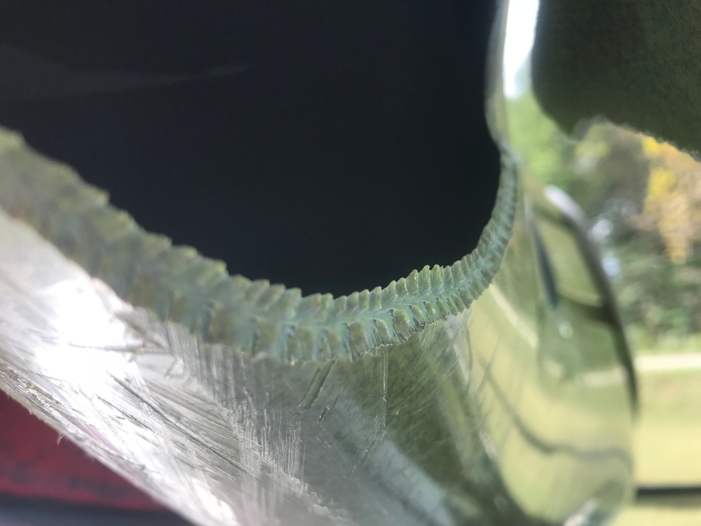
This week’s post was inspired by the photo below. Seldom will you see such lovely patterns generated by tensional failure of any material, much less polyethylene! If this type of feature is unfamiliar, just google “plumose structures” and you’ll find all you need.
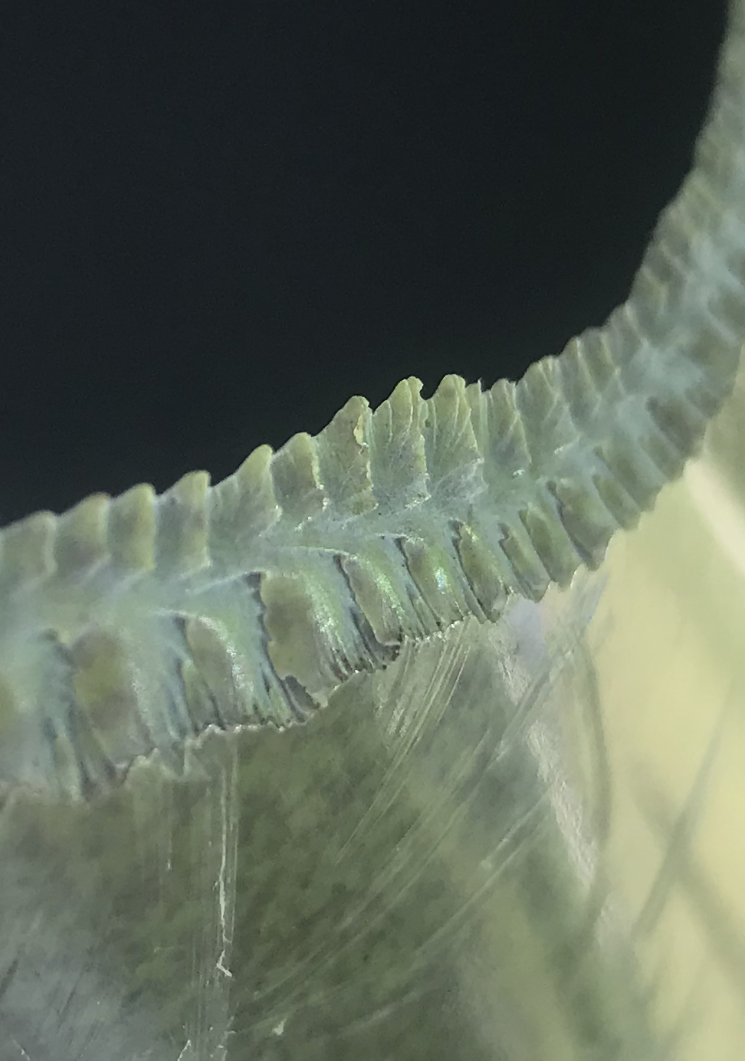
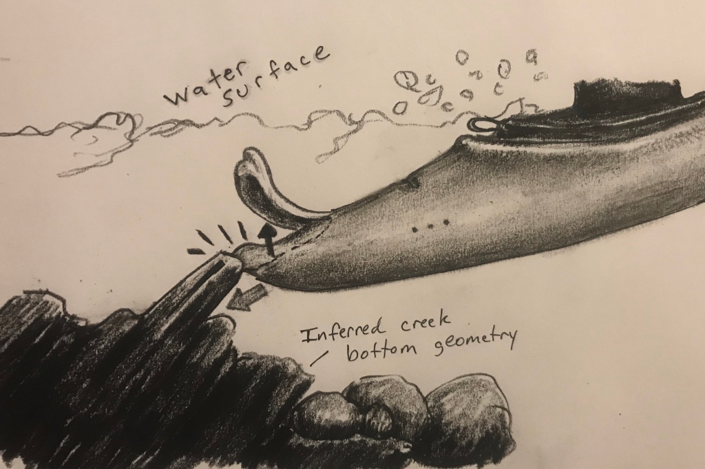
The plumose structures here formed when a whitewater kayak (not mine, thankfully) hit a rock on a creek bottom and split, ultimately peeling a good chunk of its bow upwards and backwards. The direction of peeling led to a purely tensional failure away from the localized shear failure at the point of impact. The diagram below provides a general idea. If you want to see the creek where this happened, scroll on down to the video link below. I do, however, hope you read the rest of the intro at some point.
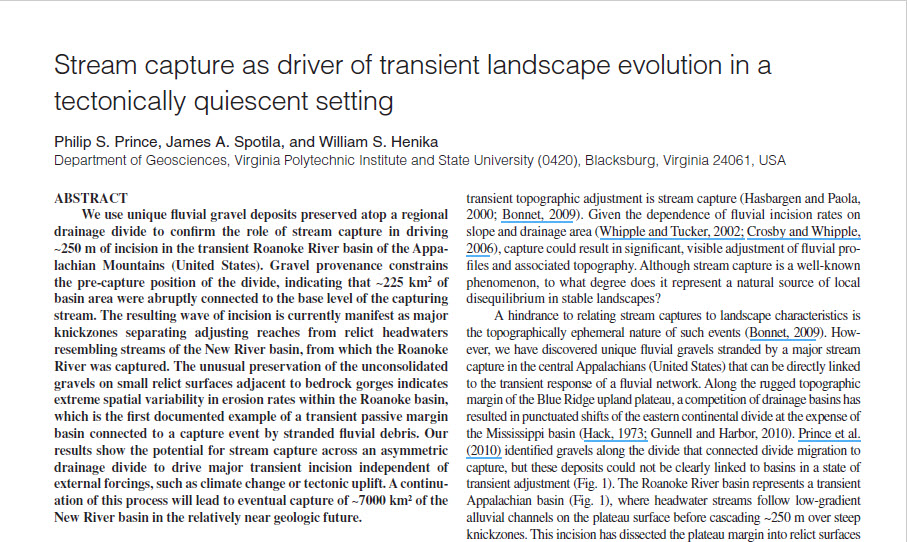
The plumose structures are cool, but I chose to write this mostly because of where they formed: the south fork of the Roanoke River, known locally as Bottom Creek, which was the centerpiece of my doctoral studies at Virginia Tech from around 2007 to 2011. Bottom Creek has whitewater because it was the victim of stream capture. It once flowed to the New River (under the word “carbonate” below) and ultimately the Gulf of Mexico across the elevated Appalachian Highlands. At some point in the geo-past, presumably less than 10 Ma (?), the headwaters of the low elevation Atlantic basin breached the Eastern Continental Divide and connected ancestral Bottom Creek to a valley system ~300 m lower than the New river system. This initiated aggressive transient incision by passive margin standards. The incision wave continues to migrate through the system today, producing challenging rapids that have a reputation for destroying boats, paddles, knuckles, and the occasional collarbone.
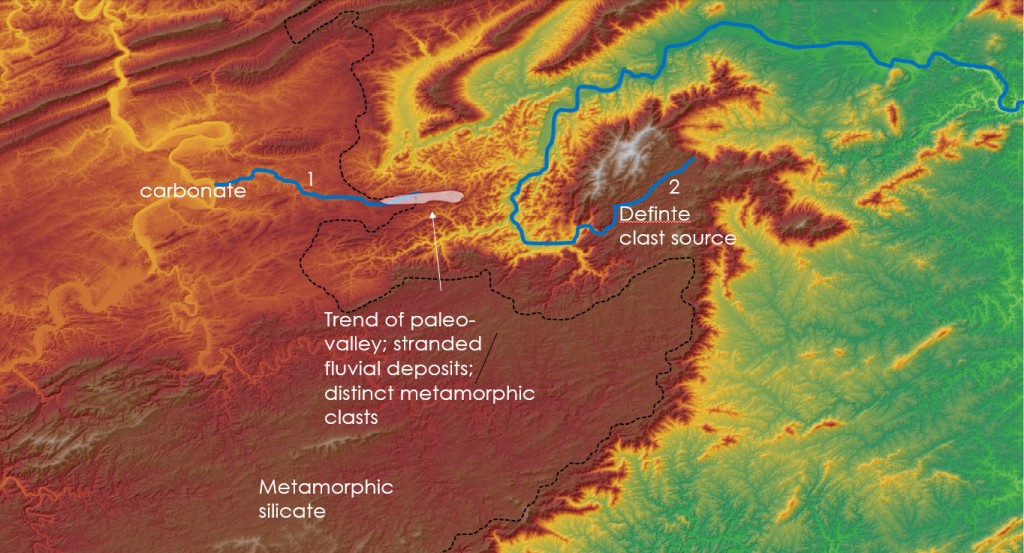
I located and characterized unconsolidated gravel deposits left “stranded” by the capture at the remaining stub of the creek (stream 1, above) still flowing to the New. Bottom Creek drains a specific suite of metamorphic Blue Ridge rocks, and the gravels stranded by its capture were obviously of fluvial origin and also of a very clear geologic, and thus geographic, origin. The rocks from which the gravels were initially eroded are now separated from the gravels’ geologically different resting place by a deep valley and the Eastern Continental Divide (the black dashed line above).
I got a Geology paper, a Ph.D., and Pardee talk out of the Bottom Creek capture, but I will readily admit that paddling its whitewater has probably been the more formative life experience.
I did not start whitewater canoeing until after I began studying stream capture, and when I found out that Bottom Creek was the local hot spot, I vowed to run it. I’ve been fortunate enough to do so many, many times since then, and being able to interact with the system academically and athletically has been remarkable.
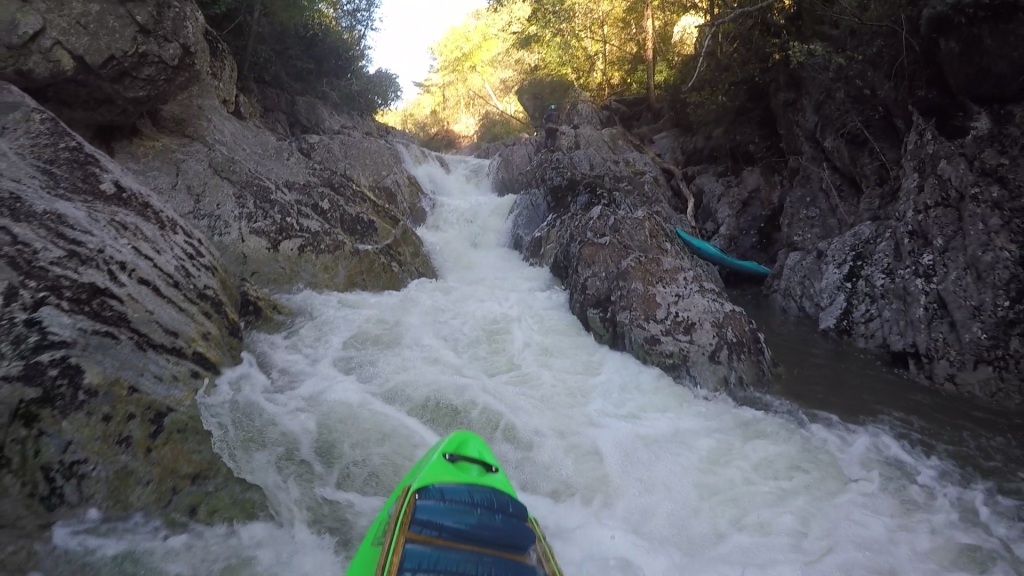
So, what does it look like in the gorge when the flow is high enough to paddle? This video gives you an idea after a brief conceptual introduction. Let me be the first to admit that this is fairly crappy raw footage; there’s no real editing, and the creek flows west-southwest, which means you look straight into the afternoon sun unless you are sheltered by a bend or cliff (shielding calculations, cosmogenic folks?). There is lots of glare and even some sloppy boating, but when I showed up last Saturday and saw the texture on the split kayak I felt geologic and thought I might try to capture a first-hand look at my old field area.
Obviously this wasn’t shot for the purpose of geologic analysis, but there are some features you can look for and check out during the video when you aren’t blinded by the sun, particularly if you pause it:
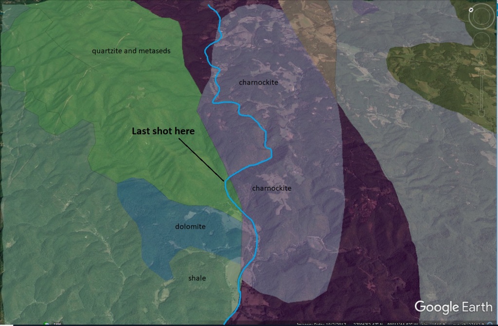
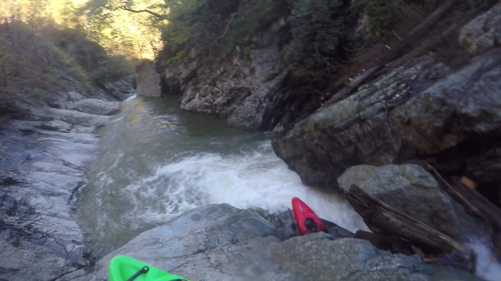
-Rapids are shown in order. The transient reach that is paddled begins quickly; the knickzone is not very “leaky,” and there is little warning of what’s coming before you get to the first rapid.
-The run is very intense until the rapid at 6:00. After this, things calm down. There is still plenty of bedrock channel, but more and more small debris collects and produces very shallow and scratchy rapids. These separate larger drops that express what’s left of the incision signal more dynamically.
-The bedrock is charnockite cut by numerous mica-rich shear zones. It’s dull and gray in most shots…
-The very last clip is shot at the Fries Fault. Bedrock changes from charnockite to metasiltstone. Usually there is a quartzite member exposed in this formation, but it’s absent here. This is almost certainly why the Atlantic base level breached the elevated New River basin at this point.
-Foliation and joint intersections are a key part of block plucking and thus incision into the bedrock. In addition to steeply-dipping joints, numerous shallower discontinuities cut across foliation to produce rhombic blocks. These have sharp edges even when rounded by water, and are the reason why Bottom Creek is so good at splitting boats.
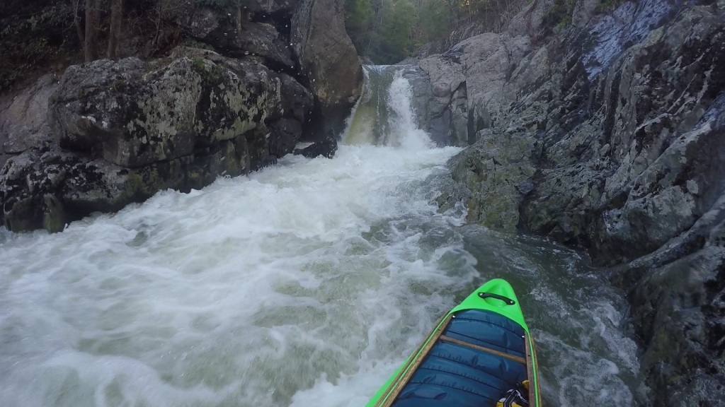

-The low-angle discontinuities likely result from the rock’s proximity to two regional thrusts, the mostly ductile Fries Fault and the brittle Blue Ridge Thrust. Similar rocks away from major thrust structures do not exhibit the complicated discontinuity patterns that intersect at very low angles.
-The steep zone of the gorge alternates between a pure bedrock streambed and accumulations of large boulders that do not move at even the highest flows.
-Foliation plane orientation relative to flow direction controls what individual rapids look like. Downstream-dipping foliation planes locally amplify the incision signal and make huge drops. You can see this in places in the video. Flat or upstream-dipping foliation planes make scratchier, rougher multi-stage drops that usually trap boulders.
-Abrasion is also very active, particularly in more micaceous domains. Some rapids are actually a set of coalesced potholes. The potholes may store very large angular tools. I plow into a submerged one of these at 3:52. Fortunately, my well-annealed boat only dented.
-You begin the whitewater run upstream of the leading edge of the incision signal. The stream is alluvial and has floodplains and even swampy areas. The first bedrock quickly appears, though, and it’s on for the next 3 or so kilometers.
-I have probably bled 5 units of blood from my knuckles into this stream.
