

by Philip S. Prince, Virginia Division of Geology and Mineral Resources
(Scroll down for summary video link)
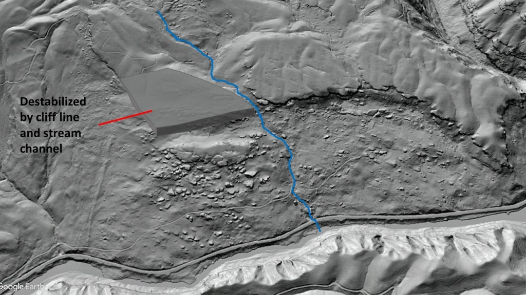
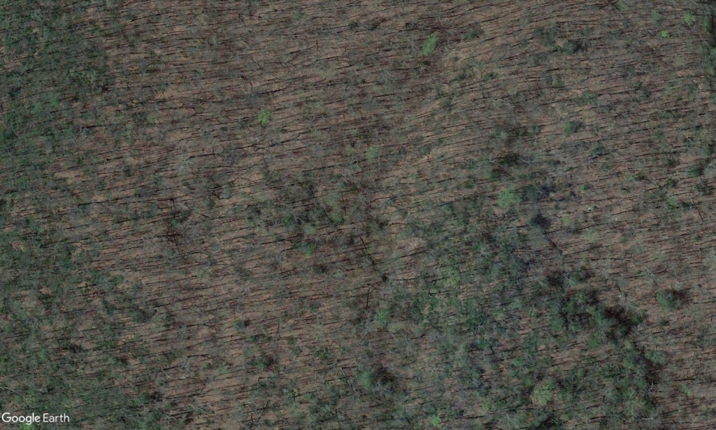
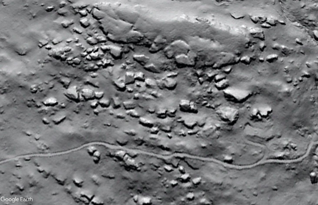
The Breaks rock slide, a large slide feature at the western edge of the Appalachian fold-thrust belt in Dickenson County, Virginia, was first described 30 years ago in Schultz and Southworth (1989). In this impressive study, the authors successfully identified several large but topographically subtle ancient landslide features without the benefit of modern digital topography. The remarkable quality of the 1989 study becomes particularly apparent when the Breaks Slide is revisited with and without 1-meter LiDAR elevation data. It is practically invisible in aerial photography, but is quite dramatic in bare-Earth hillshade, showing just how much imagery derived from LiDAR can show.
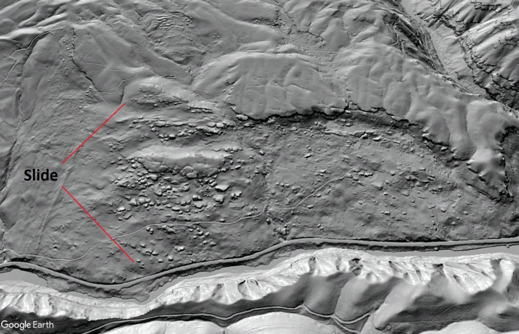
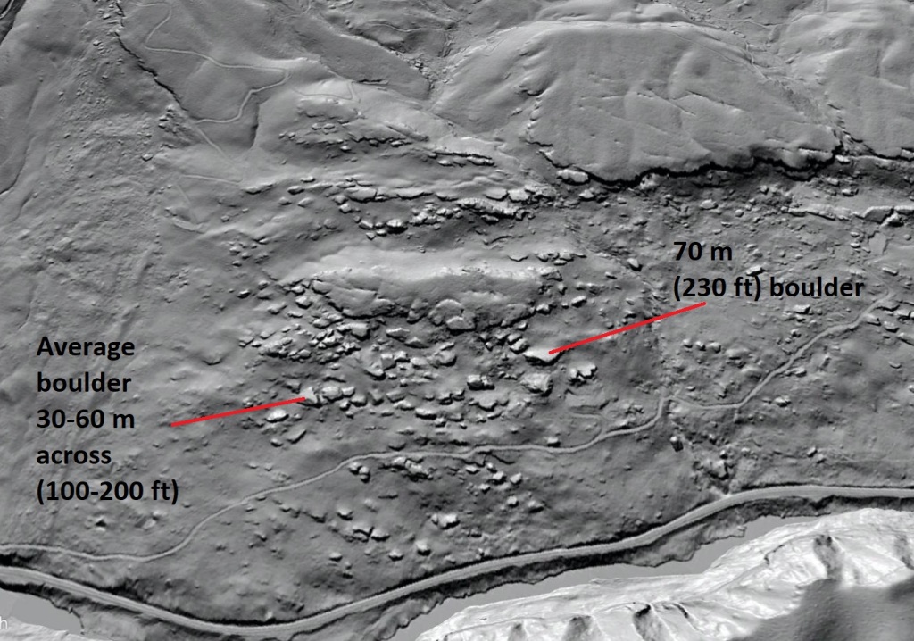
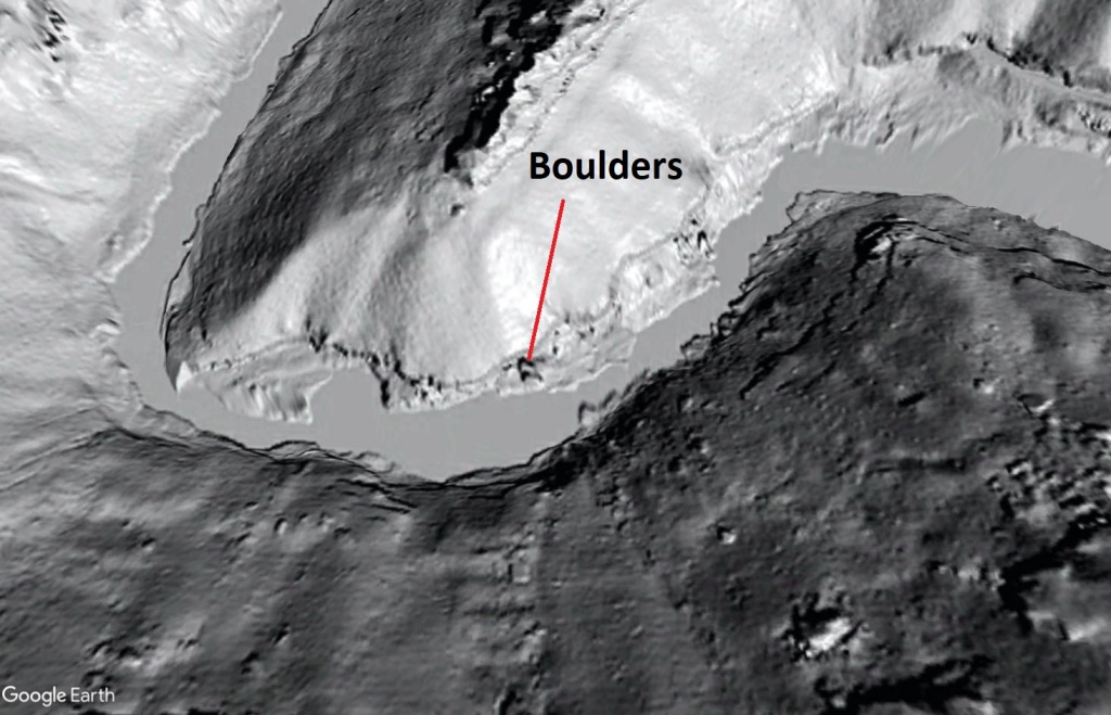
I find the physical scale of this feature difficult to visualize, presumably due to the number and distribution of boulders around the slide toe. While the boulders look like “rocks” in the hillshade image, they are actually enormous boulders between 30 and 60 meters (100-200 feet) across. The stepped cliff line developed on the sandstone sequence that sourced the slide is about 60 meters (200 feet) tall, and slide mass stretches about 800 m (~2,650 feet) from head to toe.
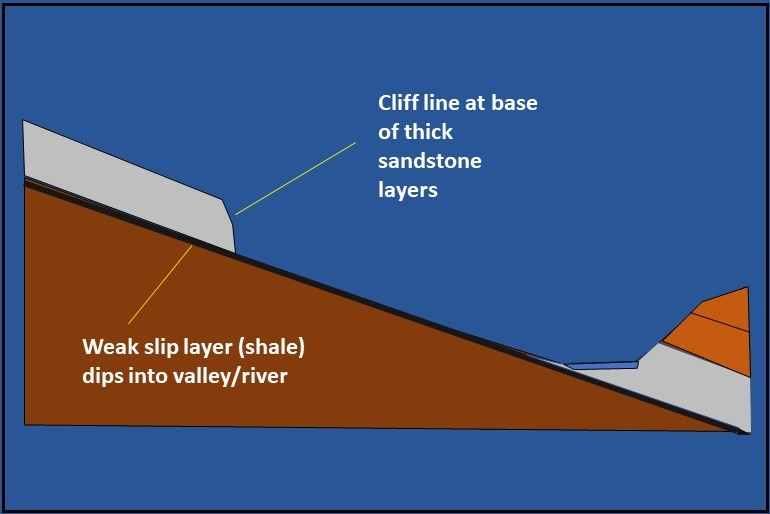
The intersection of a number of geologic and topographic circumstances set the stage for this slide to occur. Incision by the Russell Fork River steepened the walls of its gorge dramatically, leading to the development of the potentially unstable 60 meter cliff line above a very steep slope descending to river level.
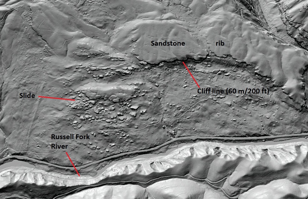
The layers into which the cliffs and steep gorge walls are carved dip gently towards the river (downhill), meaning they are tilted into the open space of the gorge and are no longer confined and supported on their downslope end. The thick sandstone rib bounded by the cliffs rests on much weaker shale, which has potential for instability when heavily loaded on steep slopes, particularly when layering dips downhill.
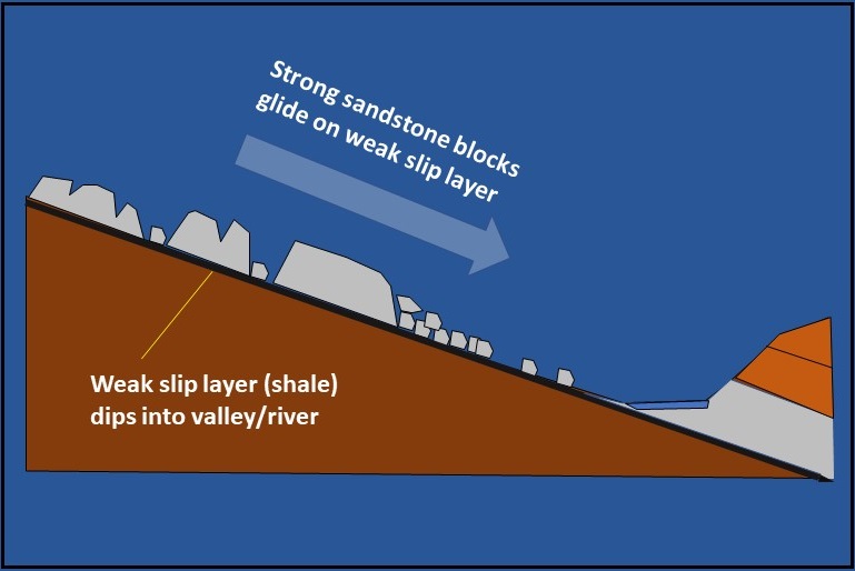
Additionally, small streams flowing towards the river have segmented the rib of thick sandstone layers into blocks ~500 m (1650 ft) across. The slide mass consists of one of these mechanically isolated blocks, which failed and experienced translational downslope movement along underlying weak shale layers. The timing and cause of failure are unknown, but Schultz and Southworth (1989) suggest the slide is quite old. The image below shows a theoretical pre-failure geometry, and the video link should provide some sense of the style of movement that produced the geometry seen today.
In addition to making the slide mass easily visible, the hillshade imagery reveals fractures and associated sinkholes in the mostly intact portion of the sandstone rib northeast of the main slide. Several small sinkholes can be seen on the rib surface, including three that are clearly aligned along a fracture. These features are definitely related to mechanical opening of the fractures as this quartzose sandstone does not dissolve like limestone.
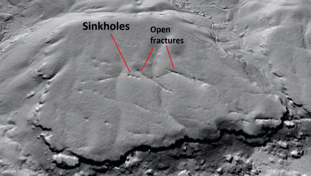
These features indicate that surface water drains into the fractures to exit in springs at the base of the cliff line, which definitely does not enhance the long-term stability of the intact portions of the sandstone rib. Vegetation patterns associated with the fracture sets are somewhat visible from aerial photography, but these features really need to be investigated in the field.
The Pennsylvanian-aged sandstones that comprise much of the body of the Breaks slide produce huge boulders in steep landscapes throughout the Appalachian Plateau (foreland basin) and western Valley and Ridge (fold-thrust belt). These boulders dominate river channels cut into the Pennsylvanian section, and are so large that they often behave like “implanted bedrock” in a channel. The boulders of the Breaks Slide are actually so large that they can be seen on a topographic map with 40 foot (12 meter) contour intervals.
The slide boulders themselves would be difficult to appreciate in the field due to their great size, vegetation covering and collection of soil and forest debris around their margins (this is why they do not appear as big white blocks in aerial photography). The photo below may provide some sense of their size and the bedding/jointing relationships of Pennsylvanian sandstones of Appalachia. Sandstone beds can be very thick, and widely spaced joints set the stage for the removal of huge boulders from sufficiently steep outcrops.
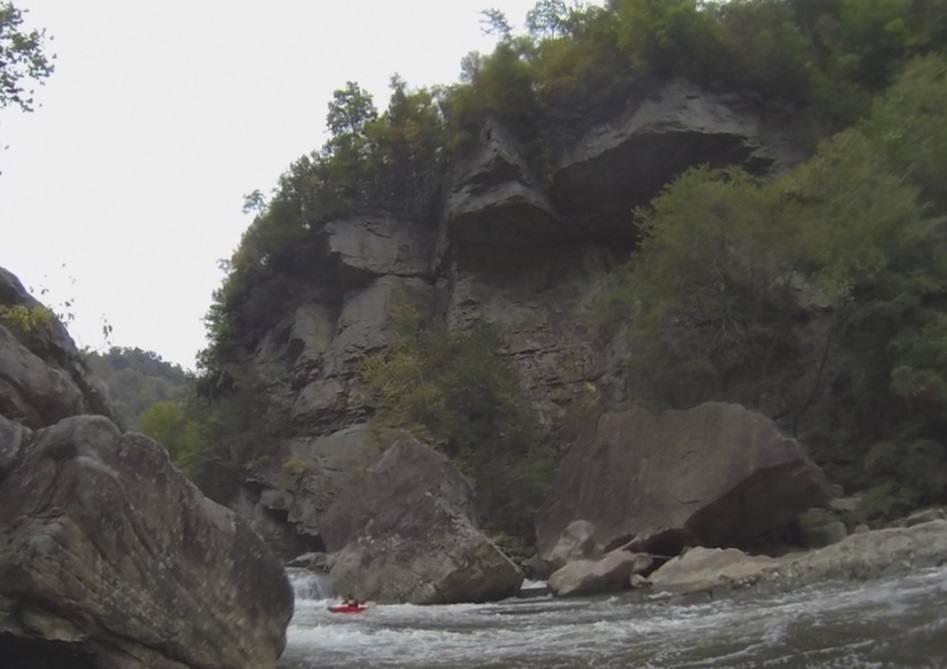
The two huge boulders behind the tiny red kayak are much smaller than the boulders produced by the Breaks Slide. If the two boulders seen above were placed end to end, they would approach the “average” boulder size in the slide’s toe area. The boulders seen in the river photo above are actually visible in LiDAR hillshade, and below they are compared to the slide’s boulders by presenting both photos at the same zoom on Google Earth.
I have spent a fair amount of time in the Russell Fork, and I had absolutely no idea that this feature existed until I came across the Schultz and Southworth paper and checked out the LiDAR. I highly recommend a Google search for any of Schultz’s and/or Southworth’s landslide work in the Appalachians–it’s all very impressive.
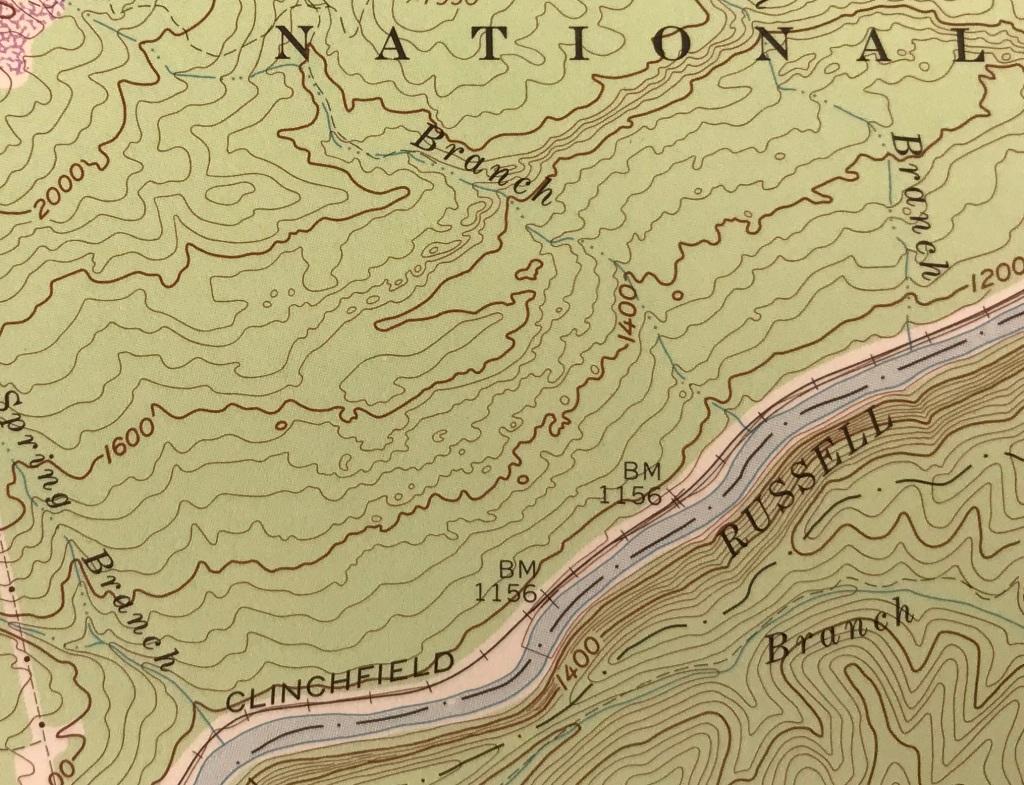
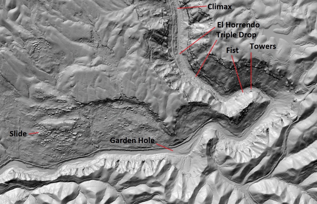
Finally, for those lucky enough to be familiar with the depths of the Russell Fork Gorge, the map below shows the location of the slide with respect to notable rapids.
Imagery from the National Map Viewer (USGS)
Overlay topography from Google Earth
